
Kiitos, että tuet tätä sivustoa ❤️
Tee lahjoitus
Tee lahjoitus
Topografinen kartta The Notch
Napsauta karttaa nähdäksesi korkeus.
Kiitos, että tuet tätä sivustoa ❤️
Tee lahjoitus
Tee lahjoitus
Tietoja tästä kartasta
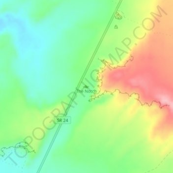
Nimi: Topografinen kartta The Notch, korkeus, helpotus.
Paikka: The Notch, Wayne County, Utah, United States (38.44901 -110.68037 38.44911 -110.68027)
Keskimääräinen korkeus: 1 409 m
Minimi korkeus: 1 349 m
Maksimi korkeus: 1 500 m
Kiitos, että tuet tätä sivustoa ❤️
Tee lahjoitus
Tee lahjoitus
Muut topografiset kartat
Napsauta karttaa nähdäksesi sen topografian, sen korkeus ja sen helpotuksen.