
Tee lahjoitus
Topografinen kartta Shafter
Napsauta karttaa nähdäksesi korkeus.
Tee lahjoitus
Tietoja tästä kartasta
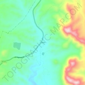
Nimi: Topografinen kartta Shafter, korkeus, helpotus.
Paikka: Shafter, Presidio County, Texas, United States (29.79736 -104.32613 29.83736 -104.28613)
Keskimääräinen korkeus: 1 256 m
Minimi korkeus: 1 131 m
Maksimi korkeus: 1 524 m
Tee lahjoitus
Muut topografiset kartat
Napsauta karttaa nähdäksesi sen topografian, sen korkeus ja sen helpotuksen.
Marfa
United States > Texas > Presidio County
Marfa experiences a semi-arid climate (BSk) with hot summers and cool winters. Due to its elevation and aridity, the diurnal temperature variation is substantial.
Keskimääräinen korkeus: 1 434 m
Marfa
United States > Texas > Presidio County
Marfa experiences a semi-arid climate (BSk) with hot summers and cool winters. Due to its elevation and aridity, the diurnal temperature variation is substantial.
Keskimääräinen korkeus: 1 434 m