Geolocate

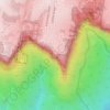
Topografinen kartta Pratten Park

Napsauta karttaa nähdäksesi korkeus.

Tietoja tästä kartasta

Nimi: Topografinen kartta Pratten Park, korkeus, helpotus.

Paikka: Pratten Park, Ashfield, Inner West, Sydney, Inner West Council, New South Wales, 2131, Australia (-33.89363 151.12200 -33.89174 151.12403)

Keskimääräinen korkeus: 29 m

Minimi korkeus: 1 m

Maksimi korkeus: 57 m

Muut topografiset kartat

Napsauta karttaa nähdäksesi sen topografian, sen korkeus ja sen helpotuksen.

Penrith

Australia > New South Wales > Sydney > Penrith

Penrith is a city in New South Wales, Australia, located in Greater Western Sydney, 55 kilometres (31 mi) west of the Sydney central business district on the banks of the Nepean River, on the outskirts of the Cumberland Plain. Its elevation is 32 metres (105 ft).

Keskimääräinen korkeus: 34 m

Randwick

Australia > New South Wales > Sydney

Keskimääräinen korkeus: 44 m

Bondi Beach

Australia > New South Wales > Sydney

Keskimääräinen korkeus: 31 m

North Sydney

Australia > New South Wales > Sydney

Keskimääräinen korkeus: 50 m

Marrickville

Australia > New South Wales > Sydney

Keskimääräinen korkeus: 17 m

Oakville

Australia > New South Wales > Sydney

Keskimääräinen korkeus: 32 m

Galston

Australia > New South Wales > Sydney

Keskimääräinen korkeus: 167 m

Heathcote

Australia > New South Wales > Sydney

Keskimääräinen korkeus: 148 m

Cronulla

Australia > New South Wales > Sydney

Keskimääräinen korkeus: 8 m

Pitt Town

Australia > New South Wales > Sydney

Keskimääräinen korkeus: 19 m

Sydney

Australia > New South Wales > Sydney

Keskimääräinen korkeus: 23 m

Killarney Heights

Australia > New South Wales > Sydney

Keskimääräinen korkeus: 72 m

Balmain

Australia > New South Wales > Sydney

Keskimääräinen korkeus: 12 m

Northbridge

Australia > New South Wales > Sydney

Keskimääräinen korkeus: 53 m

Canterbury-Bankstown Council

Australia > New South Wales > Sydney

Within the same year 16 US fighter planes that were based at Bankstown airport flew over Canterbury racecourse at low altitude during a race meet. This was to let the Australian public, especially those of the district to know that they, their allies were there for their protection. Regardless of these events,…

Keskimääräinen korkeus: 26 m

Hurstville

Australia > New South Wales > Sydney

Keskimääräinen korkeus: 50 m

Mount Colah

Australia > New South Wales > Sydney

Mount Colah is 5 km north of Hornsby, the nearest major town centre. It is one of the most northerly suburbs of Sydney and is where the "Welcome to Sydney" sign is located. Mount Colah is the second highest suburb in Sydney by elevation. Considered one of Sydney's leafier suburbs, streets are clustered around…

Keskimääräinen korkeus: 152 m

Camperdown

Australia > New South Wales > Sydney

Keskimääräinen korkeus: 26 m

Homebush

Australia > New South Wales > Sydney

Keskimääräinen korkeus: 16 m

Turramurra

Australia > New South Wales > Sydney

Keskimääräinen korkeus: 143 m

Oatley

Australia > New South Wales > Sydney

Keskimääräinen korkeus: 24 m

Rooty Hill

Australia > New South Wales > Sydney

Keskimääräinen korkeus: 52 m

North Richmond

Australia > New South Wales > Sydney

Keskimääräinen korkeus: 67 m

Botany

Australia > New South Wales > Sydney

Keskimääräinen korkeus: 6 m

Bondi Junction

Australia > New South Wales > Sydney

Keskimääräinen korkeus: 63 m

Hornsby

Australia > New South Wales > Sydney

Keskimääräinen korkeus: 160 m

Greenwich

Australia > New South Wales > Sydney

Keskimääräinen korkeus: 44 m

Blackwattle Bay

Australia > New South Wales > Sydney

Keskimääräinen korkeus: 15 m

Lane Cove

Australia > New South Wales > Sydney

Keskimääräinen korkeus: 52 m

Ku-ring-gai Chase National Park

Australia > New South Wales > Sydney

Ku-ring-gai Chase is part of the Hornsby Plateau, a massive block of sandstone tilting upwards to the north. The park comprises a plateau with an elevation of generally 150–200 m above sea level. Between 250 and 200 million years ago, sand silt and mud was deposited by rivers across flood plains. These…

Keskimääräinen korkeus: 83 m

Padstow Heights

Australia > New South Wales > Sydney

Keskimääräinen korkeus: 26 m

Yagoona

Australia > New South Wales > Sydney

Keskimääräinen korkeus: 44 m

Beverly Hills

Australia > New South Wales > Sydney

Keskimääräinen korkeus: 40 m

Box Hill

Australia > New South Wales > Sydney

Keskimääräinen korkeus: 45 m

Chipping Norton Lake

Australia > New South Wales > Sydney

Keskimääräinen korkeus: 8 m

Sydney CBD

Australia > New South Wales > Sydney

Keskimääräinen korkeus: 25 m

Edensor Park

Australia > New South Wales > Sydney

Keskimääräinen korkeus: 57 m

McMahons Point

Australia > New South Wales > Sydney

Keskimääräinen korkeus: 23 m

Smithfield

Australia > New South Wales > Sydney

Established in 1836, Smithfield was the first major settlement of the Fairfield LGA. The original 1838 summary plan of Smithfield shows the suburb laid out in a grid pattern with most of the streets having the same names as they do today. Its altitude ranges from 21 to 48 m (69 to 157 ft) above sea level.…

Keskimääräinen korkeus: 33 m

North Ryde

Australia > New South Wales > Sydney

Keskimääräinen korkeus: 52 m

Glebe

Australia > New South Wales > Sydney

Keskimääräinen korkeus: 18 m

Brighton-Le-Sands

Australia > New South Wales > Sydney

Keskimääräinen korkeus: 6 m

Barangaroo

Australia > New South Wales > Sydney

Keskimääräinen korkeus: 15 m

Dulwich Hill

Australia > New South Wales > Sydney

Keskimääräinen korkeus: 27 m

Epping

Australia > New South Wales > Sydney

Keskimääräinen korkeus: 96 m

Riverwood

Australia > New South Wales > Sydney

Keskimääräinen korkeus: 22 m

Forest Hill

Australia > New South Wales > Sydney

Keskimääräinen korkeus: 200 m

Parramatta River

Australia > New South Wales > Sydney > Parramatta

Keskimääräinen korkeus: 43 m

Bradfield

Australia > New South Wales > Sydney

Keskimääräinen korkeus: 75 m

Linden

Australia > New South Wales > Sydney

Keskimääräinen korkeus: 492 m

Gymea Bay

Australia > New South Wales > Sydney

Keskimääräinen korkeus: 29 m

Sutherland Shire

Australia > New South Wales > Sydney

Keskimääräinen korkeus: 79 m

Port Hacking

Australia > New South Wales > Sydney

Keskimääräinen korkeus: 21 m

Naremburn

Australia > New South Wales > Sydney

Keskimääräinen korkeus: 75 m

Carlingford

Australia > New South Wales > Sydney

Keskimääräinen korkeus: 98 m

Mosman

Australia > New South Wales > Sydney

Keskimääräinen korkeus: 29 m

Killara

Australia > New South Wales > Sydney

Keskimääräinen korkeus: 86 m

Greystanes

Australia > New South Wales > Sydney

Keskimääräinen korkeus: 53 m

Crows Nest

Australia > New South Wales > Sydney

Keskimääräinen korkeus: 68 m

Annandale

Australia > New South Wales > Sydney

Keskimääräinen korkeus: 24 m

Lindfield

Australia > New South Wales > Sydney

Keskimääräinen korkeus: 79 m

Botany Bay

Australia > New South Wales > Sydney

Keskimääräinen korkeus: 8 m

Kurnell

Australia > New South Wales > Sydney

Keskimääräinen korkeus: 4 m

Terrey Hills

Australia > New South Wales > Sydney

Owing to its elevation and close proximity to the ocean, as well as its extensive tree canopy cover, the weather station at Terrey Hills records the mildest temperatures of any weather station in the Greater Sydney region. Under Köppen's scheme, the suburb has a borderline humid subtropical (Cfa) and oceanic…

Keskimääräinen korkeus: 146 m

Pymble

Australia > New South Wales > Sydney

Keskimääräinen korkeus: 125 m

Cecil Hills

Australia > New South Wales > Sydney

Keskimääräinen korkeus: 77 m

Wisemans Ferry

Australia > New South Wales > Sydney

Keskimääräinen korkeus: 88 m

Holsworthy

Australia > New South Wales > Sydney

Keskimääräinen korkeus: 121 m

Engadine

Australia > New South Wales > Sydney

Keskimääräinen korkeus: 121 m

Sydney Olympic Park

Australia > New South Wales > Sydney

Keskimääräinen korkeus: 9 m

Illawong

Australia > New South Wales > Sydney

Keskimääräinen korkeus: 47 m

Ryde

Australia > New South Wales > Sydney

Keskimääräinen korkeus: 52 m

Lavender Bay

Australia > New South Wales > Sydney

Keskimääräinen korkeus: 29 m

Kentlyn

Australia > New South Wales > Sydney

Keskimääräinen korkeus: 108 m

Pemulwuy

Australia > New South Wales > Sydney

Keskimääräinen korkeus: 64 m

Freshwater

Australia > New South Wales > Sydney

Keskimääräinen korkeus: 14 m

Echo Point

Australia > New South Wales > Sydney

Keskimääräinen korkeus: 725 m

Lizard Log Park

Australia > New South Wales > Sydney

Keskimääräinen korkeus: 77 m

Sydney

Australia > New South Wales > Sydney

Keskimääräinen korkeus: 14 m

Eastern Suburbs

Australia > New South Wales > Sydney

Keskimääräinen korkeus: 12 m

Burns Bay

Australia > New South Wales > Sydney

Keskimääräinen korkeus: 27 m

Beacon Hill

Australia > New South Wales > Sydney

Keskimääräinen korkeus: 91 m

Middle Head

Australia > New South Wales > Sydney

Keskimääräinen korkeus: 9 m

Airds

Australia > New South Wales > Sydney

Keskimääräinen korkeus: 123 m

Glebe Point

Australia > New South Wales > Sydney

Keskimääräinen korkeus: 17 m

Victoria Park

Australia > New South Wales > Sydney

Keskimääräinen korkeus: 26 m

Cabarita Point

Australia > New South Wales > Sydney

Keskimääräinen korkeus: 12 m

Berry Island

Australia > New South Wales > Sydney

Keskimääräinen korkeus: 24 m

Annangrove

Australia > New South Wales > Sydney

Keskimääräinen korkeus: 60 m

Whipbird Gully

Australia > New South Wales > Sydney

Keskimääräinen korkeus: 111 m

Avalon Beach

Australia > New South Wales > Sydney

Keskimääräinen korkeus: 25 m

Scotland Island

Australia > New South Wales > Sydney

Keskimääräinen korkeus: 17 m

Woodford

Australia > New South Wales > Sydney

Woodford is a village in the Blue Mountains in New South Wales, Australia, about 90 kilometres west of Sydney. Its elevation is 609 metres (1,998 ft) above sea level. It is situated on the Great Western Highway and has a railway station (opened in 1868 as Buss's Platform) on the Main Western railway line…

Keskimääräinen korkeus: 544 m

Rockdale

Australia > New South Wales > Sydney

Keskimääräinen korkeus: 20 m

Bella Vista

Australia > New South Wales > Sydney

Keskimääräinen korkeus: 79 m

Waverton

Australia > New South Wales > Sydney

Keskimääräinen korkeus: 33 m

Berkshire Park

Australia > New South Wales > Sydney

Keskimääräinen korkeus: 27 m

St Leonards

Australia > New South Wales > Sydney

Keskimääräinen korkeus: 69 m

Denistone West

Australia > New South Wales > Sydney

Keskimääräinen korkeus: 55 m

Parsley Bay

Australia > New South Wales > Sydney > Brooklyn

Keskimääräinen korkeus: 20 m