Geolocate

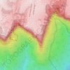
Topografinen kartta Shelly Beach

Napsauta karttaa nähdäksesi korkeus.

Tietoja tästä kartasta

Nimi: Topografinen kartta Shelly Beach, korkeus, helpotus.

Paikka: Shelly Beach, Northern Beaches, Sydney, New South Wales, Australia (-33.80090 151.29737 -33.80014 151.29850)

Keskimääräinen korkeus: 15 m

Minimi korkeus: -1 m

Maksimi korkeus: 102 m

Muut topografiset kartat

Napsauta karttaa nähdäksesi sen topografian, sen korkeus ja sen helpotuksen.

Box Hill

Australia > New South Wales > Sydney

Keskimääräinen korkeus: 45 m

Penrith

Australia > New South Wales > Sydney > Penrith

Penrith is a city in New South Wales, Australia, located in Greater Western Sydney, 55 kilometres (31 mi) west of the Sydney central business district on the banks of the Nepean River, on the outskirts of the Cumberland Plain. Its elevation is 32 metres (105 ft).

Keskimääräinen korkeus: 34 m

Botany Bay

Australia > New South Wales > Sydney

Keskimääräinen korkeus: 8 m

Wentworth Falls

Australia > New South Wales > Sydney

Wentworth Falls (postcode: 2782) is a town in the Blue Mountains region of New South Wales, situated approximately 100 kilometres (62 mi) west of the Sydney central business district, and about 8 kilometres (5.0 mi) east of Katoomba, Australia on the Great Western Highway, with a Wentworth Falls railway…

Keskimääräinen korkeus: 708 m

Mascot

Australia > New South Wales > Sydney

Keskimääräinen korkeus: 8 m

St Leonards

Australia > New South Wales > Sydney

Keskimääräinen korkeus: 69 m

Marrickville

Australia > New South Wales > Sydney

Keskimääräinen korkeus: 17 m

Sydney

Australia > New South Wales > Sydney

Keskimääräinen korkeus: 23 m

Hornsby

Australia > New South Wales > Sydney

Keskimääräinen korkeus: 160 m

Crows Nest

Australia > New South Wales > Sydney

Keskimääräinen korkeus: 68 m

Lindfield

Australia > New South Wales > Sydney

Keskimääräinen korkeus: 79 m

Camperdown

Australia > New South Wales > Sydney

Keskimääräinen korkeus: 26 m

Turramurra

Australia > New South Wales > Sydney

Keskimääräinen korkeus: 143 m

Illawong

Australia > New South Wales > Sydney

Keskimääräinen korkeus: 47 m

Yagoona

Australia > New South Wales > Sydney

Keskimääräinen korkeus: 44 m

Auburn

Australia > New South Wales > Sydney

Keskimääräinen korkeus: 21 m

Inner West

Australia > New South Wales > Sydney

Keskimääräinen korkeus: 19 m

Alfords Point

Australia > New South Wales > Sydney

Keskimääräinen korkeus: 42 m

Camden Council

Australia > New South Wales > Sydney

Keskimääräinen korkeus: 90 m

Eastwood

Australia > New South Wales > Sydney

Keskimääräinen korkeus: 80 m

Heathcote

Australia > New South Wales > Sydney

Keskimääräinen korkeus: 148 m

Lane Cove

Australia > New South Wales > Sydney

Keskimääräinen korkeus: 52 m

Northern Beaches

Australia > New South Wales > Sydney

Keskimääräinen korkeus: 67 m

Seaforth

Australia > New South Wales > Sydney

Keskimääräinen korkeus: 49 m

St Ives

Australia > New South Wales > Sydney

Keskimääräinen korkeus: 125 m

Moore Park

Australia > New South Wales > Sydney

Keskimääräinen korkeus: 43 m

Barangaroo

Australia > New South Wales > Sydney

Keskimääräinen korkeus: 15 m

Centennial Park

Australia > New South Wales > Sydney

Keskimääräinen korkeus: 51 m

Neutral Bay

Australia > New South Wales > Sydney

Keskimääräinen korkeus: 53 m

Glenorie

Australia > New South Wales > Sydney

Keskimääräinen korkeus: 131 m

Ku-ring-gai Chase National Park

Australia > New South Wales > Sydney

Ku-ring-gai Chase is part of the Hornsby Plateau, a massive block of sandstone tilting upwards to the north. The park comprises a plateau with an elevation of generally 150–200 m above sea level. Between 250 and 200 million years ago, sand silt and mud was deposited by rivers across flood plains. These…

Keskimääräinen korkeus: 83 m

Glenhaven

Australia > New South Wales > Sydney

Keskimääräinen korkeus: 132 m

Mortdale

Australia > New South Wales > Sydney

Keskimääräinen korkeus: 38 m

Shelly Beach

Australia > New South Wales > Sydney

Keskimääräinen korkeus: 6 m

Eastern Suburbs

Australia > New South Wales > Sydney

Keskimääräinen korkeus: 12 m

Newport

Australia > New South Wales > Sydney

Keskimääräinen korkeus: 27 m

Mosman

Australia > New South Wales > Sydney

Keskimääräinen korkeus: 29 m

Pitt Town

Australia > New South Wales > Sydney

Keskimääräinen korkeus: 19 m

Upper North Shore

Australia > New South Wales > Sydney

Keskimääräinen korkeus: 119 m

Tambourine Bay

Australia > New South Wales > Sydney

Keskimääräinen korkeus: 25 m

Sydney

Australia > New South Wales > Sydney

Keskimääräinen korkeus: 14 m

Burns Bay

Australia > New South Wales > Sydney

Keskimääräinen korkeus: 27 m

Como West

Australia > New South Wales > Sydney

Keskimääräinen korkeus: 31 m

Scotland Island

Australia > New South Wales > Sydney

Keskimääräinen korkeus: 17 m

Baulkham Hills

Australia > New South Wales > Sydney

Keskimääräinen korkeus: 93 m

Mount Druitt

Australia > New South Wales > Sydney

Keskimääräinen korkeus: 52 m

Kurrajong Heights

Australia > New South Wales > Sydney

Keskimääräinen korkeus: 385 m

Kingsgrove

Australia > New South Wales > Sydney

Keskimääräinen korkeus: 35 m

La Perouse

Australia > New South Wales > Sydney

Keskimääräinen korkeus: 10 m

Engadine

Australia > New South Wales > Sydney

Keskimääräinen korkeus: 121 m

Little Bay

Australia > New South Wales > Sydney

Keskimääräinen korkeus: 18 m

Balgowlah Heights

Australia > New South Wales > Sydney

Keskimääräinen korkeus: 25 m

Barden Ridge

Australia > New South Wales > Sydney

Keskimääräinen korkeus: 92 m

Forest Hill

Australia > New South Wales > Sydney

Keskimääräinen korkeus: 200 m

Blue Fish Point

Australia > New South Wales > Sydney

Keskimääräinen korkeus: 19 m

Ryde

Australia > New South Wales > Sydney

Keskimääräinen korkeus: 52 m

Cockatoo Island

Australia > New South Wales > Sydney

Keskimääräinen korkeus: 46 m

Menangle Park

Australia > New South Wales > Sydney

Keskimääräinen korkeus: 92 m

Kiola Street Reserve

Australia > New South Wales > Sydney

Keskimääräinen korkeus: 26 m

Echo Point

Australia > New South Wales > Sydney

Keskimääräinen korkeus: 725 m

Mrs Macquarie's Point / Yurong

Australia > New South Wales > Sydney

Keskimääräinen korkeus: 11 m

Wollstonecraft

Australia > New South Wales > Sydney

Keskimääräinen korkeus: 52 m

Lower North Shore

Australia > New South Wales > Sydney

Keskimääräinen korkeus: 45 m

Lizard Log Park

Australia > New South Wales > Sydney

Keskimääräinen korkeus: 77 m

Toongabbie Creek

Australia > New South Wales > Sydney

Keskimääräinen korkeus: 52 m

Gordon's Bay

Australia > New South Wales > Sydney

Keskimääräinen korkeus: 25 m

St George

Australia > New South Wales > Sydney

Keskimääräinen korkeus: 25 m

Bidwill

Australia > New South Wales > Sydney

Keskimääräinen korkeus: 49 m

Wedderburn

Australia > New South Wales > Sydney

Keskimääräinen korkeus: 211 m

Blues Point

Australia > New South Wales > Sydney

Keskimääräinen korkeus: 15 m

Moonrise Lookout

Australia > New South Wales > Sydney

Keskimääräinen korkeus: 95 m

Terry Road Lookout

Australia > New South Wales > Sydney

Keskimääräinen korkeus: 61 m

Middle Head

Australia > New South Wales > Sydney

Keskimääräinen korkeus: 9 m

Yurulbin Point

Australia > New South Wales > Sydney

Keskimääräinen korkeus: 13 m

Iron Cove

Australia > New South Wales > Sydney

Keskimääräinen korkeus: 15 m

Mosman Bay

Australia > New South Wales > Sydney

Keskimääräinen korkeus: 41 m

Coasters Retreat

Australia > New South Wales > Sydney

Keskimääräinen korkeus: 54 m

Glebe Point

Australia > New South Wales > Sydney

Keskimääräinen korkeus: 17 m

Cabramatta West

Australia > New South Wales > Sydney

Keskimääräinen korkeus: 30 m

Victoria Park

Australia > New South Wales > Sydney

Keskimääräinen korkeus: 26 m

Arcadia

Australia > New South Wales > Sydney

Keskimääräinen korkeus: 169 m

Annangrove

Australia > New South Wales > Sydney

Keskimääräinen korkeus: 60 m

Wolli Creek Regional Park

Australia > New South Wales > Sydney

Keskimääräinen korkeus: 28 m

Woodford

Australia > New South Wales > Sydney

Woodford is a village in the Blue Mountains in New South Wales, Australia, about 90 kilometres west of Sydney. Its elevation is 609 metres (1,998 ft) above sea level. It is situated on the Great Western Highway and has a railway station (opened in 1868 as Buss's Platform) on the Main Western railway line…

Keskimääräinen korkeus: 544 m

Hurstville

Australia > New South Wales > Sydney

Keskimääräinen korkeus: 50 m

Rockdale

Australia > New South Wales > Sydney

Keskimääräinen korkeus: 20 m

Bella Vista

Australia > New South Wales > Sydney

Keskimääräinen korkeus: 79 m

Waverton

Australia > New South Wales > Sydney

Keskimääräinen korkeus: 33 m

Berkshire Park

Australia > New South Wales > Sydney

Keskimääräinen korkeus: 27 m

Denistone West

Australia > New South Wales > Sydney

Keskimääräinen korkeus: 55 m

Parsley Bay

Australia > New South Wales > Sydney > Brooklyn

Keskimääräinen korkeus: 20 m

Nelson

Australia > New South Wales > Sydney

Keskimääräinen korkeus: 47 m
Beaconsfield

Australia > New South Wales > Sydney

Keskimääräinen korkeus: 18 m

Shakespeare Drive Reserve

Australia > New South Wales > Sydney

Keskimääräinen korkeus: 51 m

Peak Hill

Australia > New South Wales > Sydney

Keskimääräinen korkeus: 58 m

Smithfield

Australia > New South Wales > Sydney

Established in 1836, Smithfield was the first major settlement of the Fairfield LGA. The original 1838 summary plan of Smithfield shows the suburb laid out in a grid pattern with most of the streets having the same names as they do today. Its altitude ranges from 21 to 48 m (69 to 157 ft) above sea level.…

Keskimääräinen korkeus: 33 m

Cronulla Point

Australia > New South Wales > Sydney

Keskimääräinen korkeus: 7 m

Holroyd

Australia > New South Wales > Sydney

Keskimääräinen korkeus: 24 m

Richmond Lowlands

Australia > New South Wales > Sydney

Keskimääräinen korkeus: 13 m