Geolocate

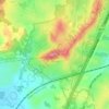
Topografinen kartta Central Gardens

Napsauta karttaa nähdäksesi korkeus.

Tietoja tästä kartasta

Nimi: Topografinen kartta Central Gardens, korkeus, helpotus.

Paikka: Central Gardens, Merrylands West, Sydney, Cumberland City Council, New South Wales, 2160, Australia (-33.83396 150.95962 -33.83051 150.96474)

Keskimääräinen korkeus: 44 m

Minimi korkeus: 23 m

Maksimi korkeus: 80 m

Muut topografiset kartat

Napsauta karttaa nähdäksesi sen topografian, sen korkeus ja sen helpotuksen.

Wentworth Falls

Australia > New South Wales > Sydney

Wentworth Falls (postcode: 2782) is a town in the Blue Mountains region of New South Wales, situated approximately 100 kilometres (62 mi) west of the Sydney central business district, and about 8 kilometres (5.0 mi) east of Katoomba, Australia on the Great Western Highway, with a Wentworth Falls railway…

Keskimääräinen korkeus: 708 m

Northern Beaches

Australia > New South Wales > Sydney

Keskimääräinen korkeus: 67 m

Penrith

Australia > New South Wales > Sydney > Penrith

Penrith is a city in New South Wales, Australia, located in Greater Western Sydney, 55 kilometres (31 mi) west of the Sydney central business district on the banks of the Nepean River, on the outskirts of the Cumberland Plain. Its elevation is 32 metres (105 ft).

Keskimääräinen korkeus: 34 m

St Ives

Australia > New South Wales > Sydney

Keskimääräinen korkeus: 125 m

Scotland Island

Australia > New South Wales > Sydney

Keskimääräinen korkeus: 17 m

Kurnell

Australia > New South Wales > Sydney

Keskimääräinen korkeus: 4 m

Zetland

Australia > New South Wales > Sydney

Keskimääräinen korkeus: 26 m

Sydney

Australia > New South Wales > Sydney

Keskimääräinen korkeus: 23 m

Newport

Australia > New South Wales > Sydney

Keskimääräinen korkeus: 27 m

Ashfield

Australia > New South Wales > Sydney

Keskimääräinen korkeus: 26 m

Roseville

Australia > New South Wales > Sydney

Keskimääräinen korkeus: 84 m

Edensor Park

Australia > New South Wales > Sydney

Keskimääräinen korkeus: 57 m

Inner West Council

Australia > New South Wales > Sydney

Keskimääräinen korkeus: 19 m

Leichhardt

Australia > New South Wales > Sydney

Keskimääräinen korkeus: 22 m

Fairfield City Council

Australia > New South Wales > Sydney

Keskimääräinen korkeus: 50 m

Mascot

Australia > New South Wales > Sydney

Keskimääräinen korkeus: 8 m

Sutherland Shire Council

Australia > New South Wales > Sydney

Keskimääräinen korkeus: 79 m

Narrabeen

Australia > New South Wales > Sydney

Keskimääräinen korkeus: 17 m

Glenfield

Australia > New South Wales > Sydney

Keskimääräinen korkeus: 29 m

Leppington

Australia > New South Wales > Sydney

Keskimääräinen korkeus: 89 m

Allambie Heights

Australia > New South Wales > Sydney

Keskimääräinen korkeus: 77 m

Thornleigh

Australia > New South Wales > Sydney

Thornleigh is bounded to the north by Waitara Creek and south by the Lane Cove National Park. Thornleigh borders the suburbs of Normanhurst, Hornsby, Wahroonga, Westleigh and Pennant Hills. Thornleigh offers great district views, and the topography varies greatly with many established areas built around…

Keskimääräinen korkeus: 159 m

Kingsford

Australia > New South Wales > Sydney

Keskimääräinen korkeus: 32 m

Bondi Beach

Australia > New South Wales > Sydney

Keskimääräinen korkeus: 31 m

Sydney

Australia > New South Wales > Sydney

Keskimääräinen korkeus: 14 m

Sutherland Shire

Australia > New South Wales > Sydney

Keskimääräinen korkeus: 79 m

Beacon Hill

Australia > New South Wales > Sydney

Keskimääräinen korkeus: 91 m

Emu Heights

Australia > New South Wales > Sydney

Keskimääräinen korkeus: 87 m

Waverton

Australia > New South Wales > Sydney

Keskimääräinen korkeus: 33 m

Camden Council

Australia > New South Wales > Sydney

Keskimääräinen korkeus: 90 m

Picnic Point

Australia > New South Wales > Sydney

Keskimääräinen korkeus: 24 m

Mount Annan

Australia > New South Wales > Sydney

Keskimääräinen korkeus: 115 m

Eastern Suburbs

Australia > New South Wales > Sydney

Keskimääräinen korkeus: 12 m

Peak Hill

Australia > New South Wales > Sydney

Keskimääräinen korkeus: 58 m

Mosman

Australia > New South Wales > Sydney

Keskimääräinen korkeus: 29 m

Baulkham Hills

Australia > New South Wales > Sydney

Keskimääräinen korkeus: 93 m

Eastwood

Australia > New South Wales > Sydney

Keskimääräinen korkeus: 80 m

Dundas Valley

Australia > New South Wales > Sydney

Keskimääräinen korkeus: 73 m

Mount Druitt

Australia > New South Wales > Sydney

Keskimääräinen korkeus: 52 m

Kronos Hill

Australia > New South Wales > Sydney

Keskimääräinen korkeus: 9 m

Balgowlah Heights

Australia > New South Wales > Sydney

Keskimääräinen korkeus: 25 m

West Pymble

Australia > New South Wales > Sydney

Keskimääräinen korkeus: 67 m

Marrickville

Australia > New South Wales > Sydney

Keskimääräinen korkeus: 17 m

Narellan

Australia > New South Wales > Sydney

Keskimääräinen korkeus: 88 m

Milsons Point

Australia > New South Wales > Sydney

Keskimääräinen korkeus: 21 m

Kiola Street Reserve

Australia > New South Wales > Sydney

Keskimääräinen korkeus: 26 m

Echo Point

Australia > New South Wales > Sydney

Keskimääräinen korkeus: 725 m

Inner West

Australia > New South Wales > Sydney

Keskimääräinen korkeus: 19 m

St Clair

Australia > New South Wales > Sydney

Keskimääräinen korkeus: 48 m

Gymea Bay

Australia > New South Wales > Sydney

Keskimääräinen korkeus: 29 m

Dobroyd Head

Australia > New South Wales > Sydney

Keskimääräinen korkeus: 16 m

Blues Point

Australia > New South Wales > Sydney

Keskimääräinen korkeus: 15 m

Lucas Heights

Australia > New South Wales > Sydney

Due to its elevation, Lucas Heights is one of the few places in Sydney that has a borderline Oceanic (Cfb) and a Humid subtropical climate (Cfa).

Keskimääräinen korkeus: 115 m

Port Hacking

Australia > New South Wales > Sydney

Keskimääräinen korkeus: 21 m

Woodford

Australia > New South Wales > Sydney

Woodford is a village in the Blue Mountains in New South Wales, Australia, about 90 kilometres west of Sydney. Its elevation is 609 metres (1,998 ft) above sea level. It is situated on the Great Western Highway and has a railway station (opened in 1868 as Buss's Platform) on the Main Western railway line…

Keskimääräinen korkeus: 544 m

Hurstville

Australia > New South Wales > Sydney

Keskimääräinen korkeus: 50 m

Rockdale

Australia > New South Wales > Sydney

Keskimääräinen korkeus: 20 m

Bella Vista

Australia > New South Wales > Sydney

Keskimääräinen korkeus: 79 m

Berkshire Park

Australia > New South Wales > Sydney

Keskimääräinen korkeus: 27 m

St Leonards

Australia > New South Wales > Sydney

Keskimääräinen korkeus: 69 m

Denistone West

Australia > New South Wales > Sydney

Keskimääräinen korkeus: 55 m

Parsley Bay

Australia > New South Wales > Sydney > Brooklyn

Keskimääräinen korkeus: 20 m

Nelson

Australia > New South Wales > Sydney

Keskimääräinen korkeus: 47 m

Beaconsfield

Australia > New South Wales > Sydney

Keskimääräinen korkeus: 18 m

Shakespeare Drive Reserve

Australia > New South Wales > Sydney

Keskimääräinen korkeus: 51 m

Smithfield

Australia > New South Wales > Sydney

Established in 1836, Smithfield was the first major settlement of the Fairfield LGA. The original 1838 summary plan of Smithfield shows the suburb laid out in a grid pattern with most of the streets having the same names as they do today. Its altitude ranges from 21 to 48 m (69 to 157 ft) above sea level.…

Keskimääräinen korkeus: 33 m

Cronulla Point

Australia > New South Wales > Sydney

Keskimääräinen korkeus: 7 m

Holroyd

Australia > New South Wales > Sydney

Keskimääräinen korkeus: 24 m

Richmond Lowlands

Australia > New South Wales > Sydney

Keskimääräinen korkeus: 13 m

Oyster Bay

Australia > New South Wales > Sydney

Keskimääräinen korkeus: 25 m

Killarney Heights

Australia > New South Wales > Sydney

Keskimääräinen korkeus: 72 m

North Curl Curl

Australia > New South Wales > Sydney

Keskimääräinen korkeus: 22 m

Darlinghurst

Australia > New South Wales > Sydney

Keskimääräinen korkeus: 38 m

Macquarie Park

Australia > New South Wales > Sydney

Keskimääräinen korkeus: 59 m

Sans Souci

Australia > New South Wales > Sydney

Keskimääräinen korkeus: 4 m

Carlingford

Australia > New South Wales > Sydney

Keskimääräinen korkeus: 98 m

Galston

Australia > New South Wales > Sydney

Keskimääräinen korkeus: 167 m

Marsfield

Australia > New South Wales > Sydney

Keskimääräinen korkeus: 72 m

Gregory Hills

Australia > New South Wales > Sydney

Gregory Hills is a suburb of Sydney in the state of New South Wales, Australia in Camden Council. The suburb was assigned on 1 August 2008. The suburb was named from the topography of the local area and from the original St Gregory's Chapel on the Marist Brothers land.

Keskimääräinen korkeus: 109 m

Oran Park

Australia > New South Wales > Sydney

Keskimääräinen korkeus: 93 m

Schofields

Australia > New South Wales > Sydney

Keskimääräinen korkeus: 32 m

Moorebank

Australia > New South Wales > Sydney

Keskimääräinen korkeus: 12 m

Killara

Australia > New South Wales > Sydney

Keskimääräinen korkeus: 86 m

Greystanes

Australia > New South Wales > Sydney

Keskimääräinen korkeus: 53 m

Cammeray

Australia > New South Wales > Sydney

Prior to the 1920s, the suburb was known as Suspension Bridge reflecting the now Long Gully Bridge that joined Northbridge to Cammeray. Cammeray was slow to develop mainly due to its steep topography and remoteness from transport.

Keskimääräinen korkeus: 66 m

Bringelly

Australia > New South Wales > Sydney

Keskimääräinen korkeus: 87 m

Crows Nest

Australia > New South Wales > Sydney

Keskimääräinen korkeus: 68 m

Londonderry

Australia > New South Wales > Sydney

Keskimääräinen korkeus: 29 m

Annandale

Australia > New South Wales > Sydney

Keskimääräinen korkeus: 24 m

Randwick

Australia > New South Wales > Sydney

Keskimääräinen korkeus: 44 m

North Ryde

Australia > New South Wales > Sydney

Keskimääräinen korkeus: 52 m

Rydalmere

Australia > New South Wales > Sydney

Keskimääräinen korkeus: 19 m

Lane Cove Municipal Council

Australia > New South Wales > Sydney

Keskimääräinen korkeus: 41 m

Liverpool

Australia > New South Wales > Sydney

Keskimääräinen korkeus: 14 m

Warragamba

Australia > New South Wales > Sydney

Keskimääräinen korkeus: 157 m

Gladesville

Australia > New South Wales > Sydney

Keskimääräinen korkeus: 28 m

Meadowbank

Australia > New South Wales > Sydney

Keskimääräinen korkeus: 19 m

Drummoyne

Australia > New South Wales > Sydney

Keskimääräinen korkeus: 11 m

North Parramatta

Australia > New South Wales > Sydney

Keskimääräinen korkeus: 42 m

Lindfield

Australia > New South Wales > Sydney

Keskimääräinen korkeus: 79 m